Japanese Archipelago K-12 Free Map Download
Japanese Archipelago K-12 Free Map Download
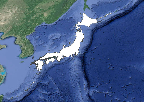
【日本列島 Japanese Archipelago】
用語:
英語:The Japanese Archipelago
別名:列島(れっとう)・ジャパン・ジパング
解説:日本列島とは、ユーラシア大陸の東側に浮かぶ大小6800の島島です。
The Japanese archipelago is a group of 6,800 islands, large and small, located in the eastern part of the Eurasian continent, collectively called Japan.
西欧文化圏では、イタリア人の冒険家マルコポーロが、最初に、日本列島をジパングと紹介しました。
In Western culture, Marco Polo, an Italian adventurer, first introduced the Japanese archipelago as Zipangu.
なお、日常の日本語では、ジャパンという名称よりは、日本という名称を用います。ドイツ人が、自国をジャーマンと呼ぶよりは、ドイチェランドと呼ぶことと、同じです。
In everyday life, the Japanese use Nihon(日本) rather than Japan, just as Germans call their country Deutschland rather than Germany.
音声:
【Japanese Archipelago K-12 Free Map Download】
Map Japanese Archipelago
Map Japanese Archipelago All
Map Japanese Archipelago PureWhite
Map Japanese Archipelago Major Lands Q
Map Japanese Archipelago Major Lands A
【Japanese Archipelago In a Nutshell】
日本列島は、ユーラシア大陸の東側に位置する。
The Japanese archipelago is located on the eastern side of the Eurasian continent.
日本列島は、大小6000の島島から構成される。
The Japanese archipelago is composed of 6,000 islands of various sizes.
日本列島の四大島とは、面積の順番で、本州・北海道・九州・四国のことである。
The four major islands of the Japanese archipelago are Honshu(本州), Hokkaido(北海道), Kyushu(九州) and Shikoku(四国) by area.
日本は、国境を海に囲まれている海洋国家で、島国とも呼ばれる。
Japan is a maritime nation surrounded by the sea, also known as an island nation(島国).
プロ家庭教師の社会地理教材で、指導歴10年以上の講師が執筆しています。
【科目】
社会地理 (公立小学校カリキュラム+中学受験カリキュラム)
【領域】
地理 > 日本列島全体
【対象生徒】
小学生(小学4年+小学5年+小学6年)
中学受験生
質問と回答